Mirror Lake Bathymetry
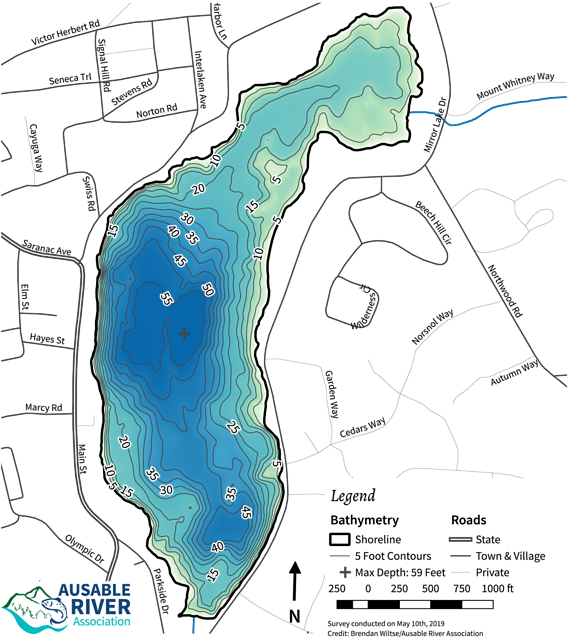
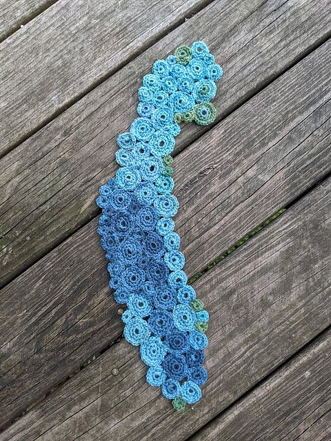
Bathymetry is the underwater analog of topography and is commonly mapped similarly with contour lines that represent depth at different regions of a lake bottom. In this crocheted example, darker colors indicate deeper regions of the lake. This was made with simple crochet circles in varying colors pieced together to align with the approximate bathymetry pattern of the lake as mapped by the Ausable Freshwater Center, with whom we work to monitor and understand threats to this important waterbody.
More info available here on Ravelry.


